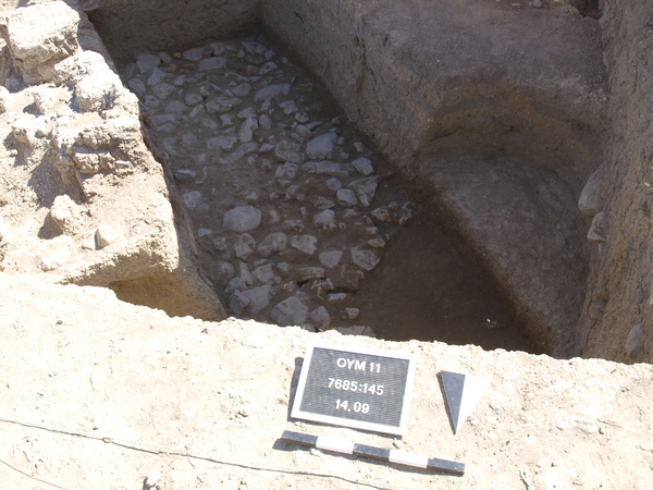
Wall Locus:7685:145 is a stone surface that can be identified as the top of the stone foundation of wall Locus:7685:038 (west), Locus:7685:013 (east) and an unburnt mud-brick wall in the northwest corner of the square.
It consists of a large number of small, medium and large-sized stones.
Small stones (in cm): 10 x 5-10
Medium stones (in cm): 13-19 x 12-16
Large stones (in cm): 20-32 x 13-24
In the final report of the 2011 excavation campaign it is argued that wall Locus:7685:145 may also be interpreted as a stone pavement belonging to the first architectural phase of the south facade of the central building complex. Other associated features are wall Locus:7685:038 , wall Locus:7685:013 , stone installation/pavement Locus:7685:132 , wall Locus:7685:100 and floor Locus:7685:149 / Locus:7785:086 .
More details can be found in the final report of the 2011 excavation campaign.